


Precinct 4, Gosper County, Nebraska
About
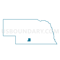
Outline

Summary
| Unique Area Identifier | 613192 |
| Name | Precinct 4 |
| County | Gosper County |
| State | Nebraska |
| Area (square miles) | 125.23 |
| Land Area (square miles) | 125.21 |
| Water Area (square miles) | 0.03 |
| % of Land Area | 99.98 |
| % of Water Area | 0.02 |
| Latitude of the Internal Point | 40.39668660 |
| Longtitude of the Internal Point | -99.90046800 |
Maps


Graphs
Select a template below for downloading or customizing gragh for Precinct 4, Gosper County, Nebraska


Neighbors
Neighoring Voting District (by Name) Neighboring Voting District on the Map
- Arapahoe Precinct, Furnas County, NE
- Cambridge Precinct, Furnas County, NE
- Edison Precinct, Furnas County, NE
- Eustis Precinct, Frontier County, NE
- Holbrook Precinct, Furnas County, NE
- Oxford Precinct, Furnas County, NE
- Precinct 2, Gosper County, NE
- Precinct 3, Gosper County, NE
- Stockville Precinct, Frontier County, NE
Top 10 Neighboring County Subdivision (by Population) Neighboring County Subdivision on the Map
- Cambridge precinct, Furnas County, NE (1,270)
- Arapahoe precinct, Furnas County, NE (1,200)
- Holbrook precinct, Furnas County, NE (333)
- Edison precinct, Furnas County, NE (237)
- New Era precinct, Furnas County, NE (114)
- Lincoln precinct, Gosper County, NE (79)
- Elk Creek precinct, Gosper County, NE (54)
- Union precinct, Gosper County, NE (43)
- West Muddy precinct, Gosper County, NE (42)
- East Muddy precinct, Gosper County, NE (35)
Top 10 Neighboring Unified School District (by Population) Neighboring Unified School District on the Map
- Southern Valley Schools, NE (2,895)
- Arapahoe Public Schools, NE (1,905)
- Elwood Public Schools, NE (1,828)
- Cambridge Public Schools, NE (1,550)
- Bertrand Public Schools, NE (1,433)
Top 10 Neighboring State Legislative District Upper Chamber (by Population) Neighboring State Legislative District Upper Chamber on the Map
Top 10 Neighboring 111th Congressional District (by Population) Neighboring 111th Congressional District on the Map
Top 10 Neighboring Census Tract (by Population) Neighboring Census Tract on the Map
- Census Tract 9639, Furnas County, NE (4,959)
- Census Tract 9611, Frontier County, NE (2,756)
- Census Tract 9676, Gosper County, NE (2,044)
Top 10 Neighboring 5-Digit ZIP Code Tabulation Area (by Population) Neighboring 5-Digit ZIP Code Tabulation Area on the Map
- 69022, NE (1,570)
- 68922, NE (1,336)
- 68927, NE (1,164)
- 68967, NE (1,142)
- 68948, NE (363)
- 68976, NE (316)
- 68936, NE (243)